
Determining Best Management Practices in Big Sunflower River Watershed
MAFES scientists work to manage nutrients in Mississippi's waters
By: Vanessa Beeson
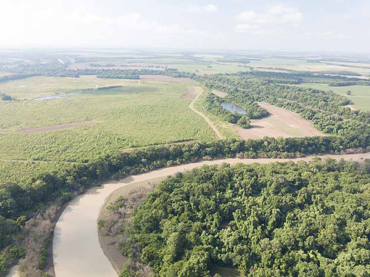
Aerial view of the Big Sun Flower River, which begins in Coahoma County and covers 250 miles. (Photo by Sean Pruett and Kenner Patton)
The information presented on this page may be dated. It may refer to situations which have changed or people who are no longer affiliated with the university. It is archived as part of Mississippi State University's history.
The Big Sunflower River Watershed begins in Coahoma County and covers 250 miles before it reaches the Yazoo River, a tributary of the Mississippi River. Its watershed encompasses approximately 4,700 square miles. Surrounded by rich agricultural land, the Big Sunflower River Watershed has been impacted by surrounding land use including agricultural water withdrawals from the Mississippi River Valley Alluvial Aquifer. Additionally, runoff from agricultural lands has increased nutrient levels in the waterbody. To help find solutions for this non-point-source pollution, Dr. Prem Parajuli sought to evaluate the impact of best management practices on the watershed's water quality.
Part of a larger research project funded through the United States Department of Agriculture's National Institute of Food and Agriculture, Parajuli investigated the impacts of best management practices, or BMPs, including tailwater recovery systems on the watershed. Tailwater recovery systems capture and store water from rain events and runoff to redistribute in irrigation.
"We estimated potential tailwater recovery ponds using satellite imagery data, evaluated impacts of BMPs including conservation tillage and tailwater recovery systems, and quantified the impacts of crop rotation change on surface water hydrology and water quality," Parajuli explained.
The study used a Soil and Water Assessment Tool (SWAT) model in conjunction with field-observed hydrology and water quality data from three U.S. Geological Survey (USGS) gauge stations located in Merigold, Sunflower, and Leland, Mississippi. The model incorporated data from USGS, USDA National Agricultural Statistics Service, and the National Oceanic and Atmospheric Administration's National Climatic Data Center. The team assessed elevation, land use and cover, and climate data, in conjunction with crop management information including amount of irrigation and fertilization. The team estimated the number and location of tailwater recovery ponds by using a combined digital water body detection and spatial characteristics of the water body. Ground water level data from monitoring wells were utilized from the Yazoo Mississippi Delta Joint Water Management District to validate the model-simulated groundwater storage changes within the watershed. The SWAT model was calibrated for hydrologic and water quality components using field observed data and statistical analysis techniques. The study evaluated BMPs including conservation practices, tillage management, and tailwater recovery ponds.
First, the researchers calibrated and validated the model for hydrology and water quality evaluations and then determined the impact of BMPs on water quality.
"This study demonstrated model simulation methods including use of satellite imagery data to evaluate the impacts of BMPs like tailwater recovery ponds on hydrology and water quality processes at the watershed scale, which is unique," he said. "The SWAT model simulation results determined that tailwater recovery ponds can reduce sediment transport up to 20 percent and improve groundwater storage."
Parajuli also said BMPs, such as the use of conservation tillage, increased rainfall infiltration and reduced runoff by up to 53 percent compared to a conventional tillage scenario. The use of conservation tillage reduced cumulative sediment and nutrient transport, results that are similar to other MAFES studies. Relative to a continuous corn system, a corn-soybean rotation affected nitrogen and phosphorus loss in different ways.
Parajuli will continue to investigate issues related to water management within the Big Sunflower River Watershed, as well as other watersheds throughout the state, nation, and globe.
"I would like to develop methods and use tools to bring engineering solutions to our multi-faceted water challenges," he said. "My goals also include presenting my research in local settings so that watershed managers and producers can benefit from our recommendations. We will continue to publish our work in reputed journals to reach researchers around the world."
Collaborators in the Big Sunflower River Watershed project included Xiaojing Ni, a doctoral student under the direction of Parajuli; Dr. Ying Ouyang with the U.S. Forest Service; Dr. Padmanava Dash, assistant professor in the Department of Geosciences; Dr. Courtney Siegert, assistant professor in the Department of Forestry and the Forest and Wildlife Research Center; and Steve Walker, GIS operations manager with Mississippi Automated Resource Information System. In addition to funding from the United States Department of Agriculture, National Institute of Food and Agriculture, the Yazoo Mississippi Delta Joint Water Management District and USGS contributed to the work.
Behind the Science

Prem Parajuli
Associate Professor
Education: B.S., Civil Engineering/Public Administration, Tribhuvan University; M.S., Biosystems Engineering/Agronomy, Auburn University; Ph.D., Biological and Agricultural Engineering, Kansas State University
Years At MSU: 10
Focus: Hydrological and water quality monitoring, modeling, conservation of water resources, and environmental engineering
Passion At Work: I am interested in further understanding water-energy-food-nexus to improve ecosystem services using GIS, remote sensing, and modeling tools at local, regional, and continental scales.

Matthew Interis
Associate Professor
Education: B.A., Music and Economics, Binghamton University; M.S., Economics, Ph.D., Agricultural, Environmental and Developmental Economics, The Ohio State University
Years At MSU: 10
Focus: Estimating the economic value of services provided by ecosystems and examining the environmental impacts of people’s food consumption choices
Passion At Work: How bad is it to pollute? How good is it to restore wildlife habitat? Any problem where I can help people understand the “how bad” or the “how good” of some environmental effect from an economic point of view.