
Measuring soil erosion from above
By: Karen Brasher
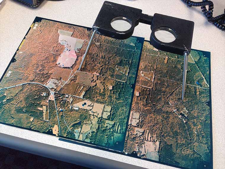
Images from a UAV are used to measure and track soil erosion. (Photo submitted)
The information presented on this page may be dated. It may refer to situations which have changed or people who are no longer affiliated with the university. It is archived as part of Mississippi State University's history.
As our soils slowly, but surely, slip away, erosion is visible across the landscape. The long-term effects of that erosion, however, are somewhat hidden.
According to the United Nations' Food and Agriculture Organization, the earth loses the equivalent of a soccer field of soil every five seconds, reducing crop yields in places by up to 50 percent.
At the field level, lost soil productivity from erosion effects crop yields while off-site impacts include sedimentation and eutrophication-when the waterways receive too many nutrients resulting in the growth of algae.
Scientists in the Mississippi Agricultural and Forestry Experiment Station are taking an aerial approach to assessing soil erosion in hopes of determining the best locations to implement conservation practices.
Dr. Joby Czarnecki, a MAFES scientist in the Geosystems Research Institute, is using unmanned aerial vehicles, or UAVs, to perform structure from motion analysis and monitoring of erosion at MAFES facilities including the Bearden Dairy Research Center and the H. H. Leveck Animal Research Center.
Structure from motion is a technique that builds 3D structure from 2D images. Czarnecki is estimating three dimensional surfaces from two dimensional images, using the multiple angles from the UAV to determine elevation, among other variables.
Czarnecki said the research has been largely trial and error as MAFES scientists look to perfect collection techniques and processing to obtain accurate measurements for analysis of soil erosion.
Through visual inspection, Czarnecki has isolated the areas that exhibit erosion, evidenced by channels created in the soil. However, collecting the images through an unmanned aerial vehicle can be tedious.
"We use a low-cost UAV, but the drawback is lower accuracy from the aircraft's GPS. Correct position information is critical to recreate accurate structure," Czarnecki said. "That is why we need multiple points of calibration and referencing on the landscape to ensure the images we take from multiple angles are giving us accurate elevations in the study area."
Prior to flight, technicians use survey-grade GPS units to place 20 control points with known longitude, latitude, and elevation. These points are supplied to the computer program when the 3D structure is generated to tie down the placement of the images rendered by the UAV.
An additional 20 reference points are placed and recorded, but not supplied to the computer. Once the 3D structure is generated, these reference points are verified against the true measurements taken in the field to ensure the location and elevation are accurate.
The team has met a few obstacles along the way including the seasonal variability of the earth's surface, for instance summer vegetation can provide a different measurement compared to plants in the winter since the UAV is measuring the distance to the surface.
"Changes in vegetation present challenges for year-long monitoring efforts and require additional processing," Czarnecki said. "Overall, the UAV is working well on flat surfaces, but it becomes a little more difficult with sloped surfaces and heavily vegetated areas. This requires us to develop more digital terrain and elevation models, which show the true soil surface. To have this type of output, elevated objects such as trees must be removed during processing."
The team is also exploring the use of sediment tracers which determine how far and fast materials move in the soil.
"The florescent coating on tracer material stands out from the soil," she said. "If the sensor on the UAV can be matched in its detection window to the color of the tracer, the UAV can identify where the tracer has been moved by water. Movement of tracers is a model for how soil will be moved within the same area and allows researchers to understand where soil losses are greatest and where removed soil will accumulate downstream."
Tracer material has been used to detect sand movement in a previous study. The UAV has been shown to be capable of detecting the tracer material in sand in a controlled environment. Now the testing is underway to determine if the UAV can detect low concentrations of tracer material at the level required for field study.
"If we succeed in the beach environment, our next step will be to move to agricultural landscapes. Tracers would allow us to see the erosion clearly and determine the best placement of conservation practices to stop erosion. We could also use the tracer after installation to ensure the sediment are being stopped by preventive measures," Czarnecki said. "If we can get the tracer to work, it would be a useful tool for precision conservation, particularly for siting of conservation practices and quantifying benefits."